

DRIFT
Title: DRIFT – Detection and Re-Identification of Icebergs as Flow Tracers
Project duration: 01.11.2024 – today
Research Area: Earth and Environmental Sciences, Glaciology, Fjord Oceanography, Computer Vision, Multi-Object Tracking, Deep Learning
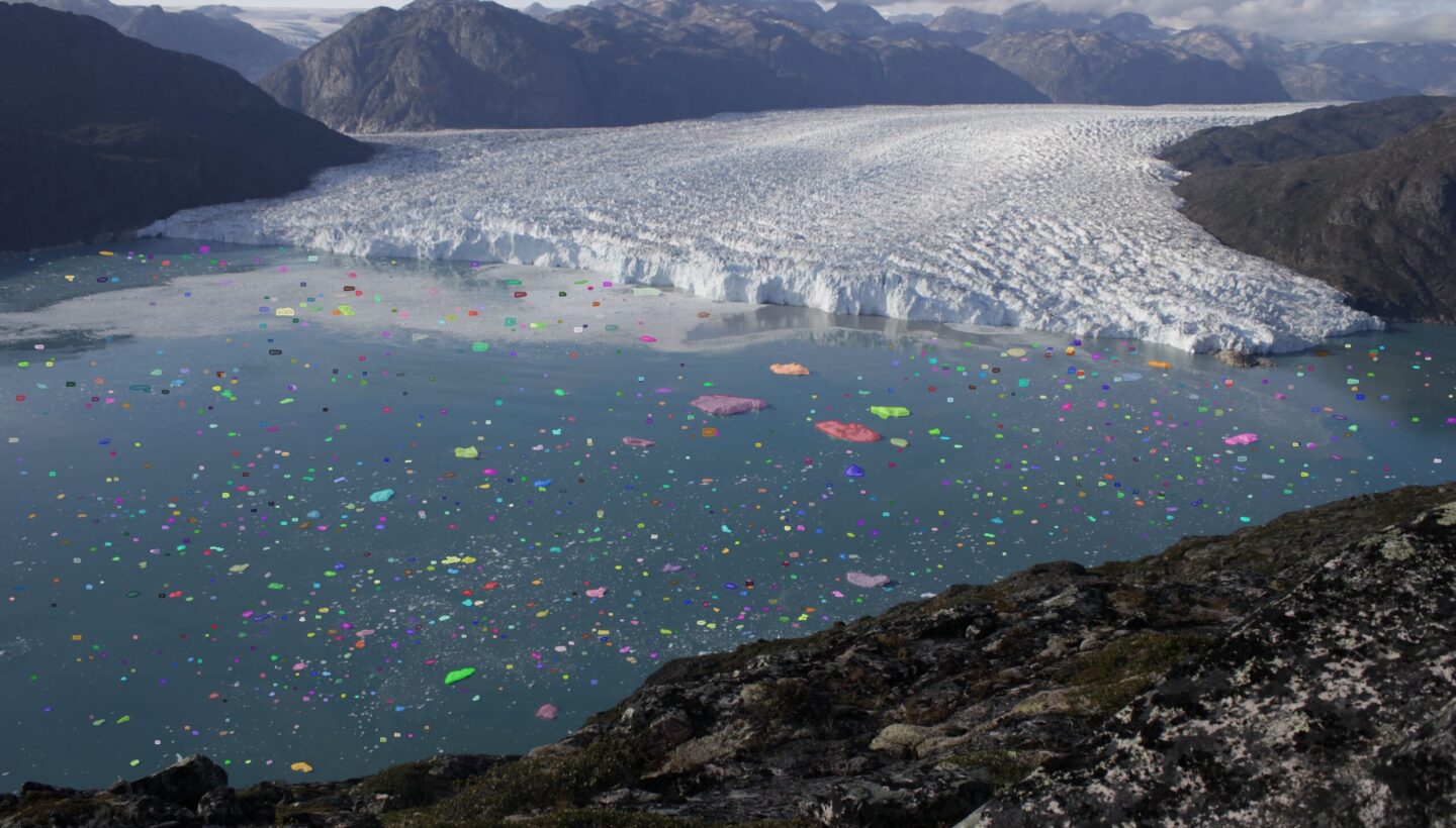
Marine-terminating glaciers are critical gateways for global sea level rise, with their stability strongly influenced by complex fjord circulation patterns that regulate submarine melting. Direct observations of these mechanisms with conventional oceanographic instruments remain challenging. However, the fjords themselves contain a distributed sensor network: icebergs. As passive tracers driven by ocean currents, icebergs of different sizes respond to water circulation at different depths due to their varying keel depths. DRIFT is an iceberg tracking framework that extracts dense iceberg velocity fields from time-lapse imagery. The project established a pipeline that detects individual icebergs in terrestrial time-lapse imagery, re-identifies them from frame to frame and reconstructs their trajectories. Georeferencing converts these image trajectories into real-world velocities and circulation patterns.
Aims
DRIFT aims to make fjord surface circulation observable. It detects and reliably re-identifies icebergs across a wide range of sizes, enabling trajectories to be maintained over long time-lapse sequences without site-specific retraining for individual glaciers, environmental conditions, or camera setups.
Problems
Fjord circulation influences glacier-front retreat by transporting warm ocean water toward glaciers. Conventional oceanographic instruments have spatial and temporal constraints, and ice-choked fjords are largely inaccessible to ships and moorings. This project investigates whether individual icebergs can be tracked reliably enough to serve as a distributed sensor network for fjord surface flow.
Practical Example
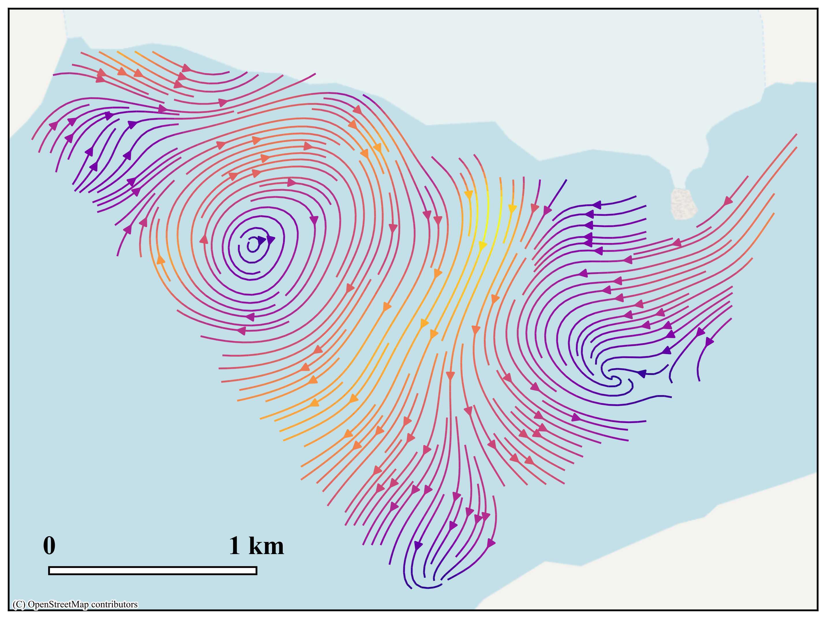
The framework has been applied and evaluated on time-lapse imagery in Greenland (Eqalorutsit Kangilliit Sermiat and Eqip Sermia glacier), where it produces surface velocity fields and circulation maps.
Technology
Vision Transformers, Convolutional Neural Networks, Representation Learning, Multi-Object Tracking, Kalman Filtering, Photogrammetry and Georeferencing
Team
Lead
Dr. Josefine Umlauft
Members
Marco Jaeger-Kufel – ScaDS.AI Dresden/Leipzig, Leipzig University
Anja Neumann – ScaDS.AI Dresden/Leipzig, Leipzig University
Prof. Andreas Vieli – Department of Geography, University of Zurich
Dr. Ethan Welty – Department of Geography, University of Zurich
Dr. Andrea Kneib-Walter – Department of Geography, University of Zurich
Partners





Dresden
ScaDS.AI Dresden/Leipzig
Bürogebäude Strehlener Straße
Strehlener Straße 12, 14
01069 Dresden
Zentrum für Informationsdienste und Hochleistungsrechnen
ScaDS.AI Dresden/Leipzig
01062 Dresden
Leipzig
Löhrs Carré
Humboldtstraße 25, Uferstr. 11
04105 Leipzig
Data Science Center ScaDS.AI Leipzig
Internes Postfach: 322001
04081 Leipzig
Quicklinks:
Copyright 2026 © SCADS.AI Dresden/Leipzig – All rights reserved.