During the RESOLVE project („High-resolution imaging in subsurface geophysics: development of a multi-instrument platform for interdisciplinary research“), continuous surface displacement and seismic array observations were obtained on Glacier d’Argentière in the French Alps for 35 days in May 2018. The data set is used to perform a detailed study of targeted processes within the highly dynamic cryospheric environment. In particular, the physical processes controlling glacial basal motion are poorly understood and remain challenging to observe directly. Especially in the Alpine region for temperate based glaciers where the ice rapidly responds to changing climatic conditions and thus, processes are strongly intermittent in time and heterogeneous in space.
Spatially dense seismic and GPS measurements are analyzed applying machine learning to gain insight into the processes controlling glacial motions of Glacier d’Argentière. Using multiple bandpass-filtered copies of the continuous seismic waveforms, we compute energy-based features, develop a matched field beamforming catalogue and include meteorological observations. Features describing the data are analyzed with a gradient boosting decision tree model to directly estimate the GPS displacements from the seismic noise.
We posit that features of the seismic noise provide direct access to the dominant parameters that drive displacement on the highly variable and unsteady surface of the glacier. The machine learning model infers daily fluctuations and longer term trends. The results show on-ice displacement rates are strongly modulated by activity at the base of the glacier. The techniques presented provide a new approach to study glacial basal sliding and discover its full complexity.
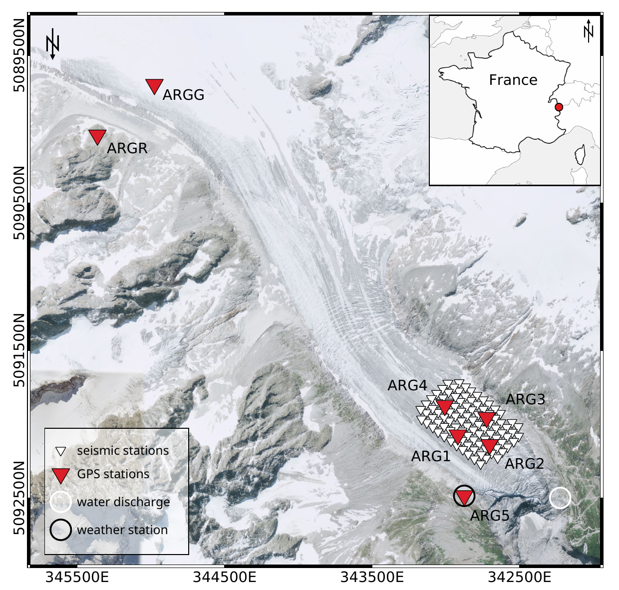 Overview map of Glacier d’Argentière together with the RESOLVE sensor infrastructure (Gimbert et al., 2021) including the locations of the seismic nodes (white triangles), the GPS stations (red triangles, ARGx), the weather station (black circle around ARG5) and the location of the borehole for measurements of water discharge (white circle).
More to it:
Mapping glacier basal sliding applying machine learning